Routes / Rivers & small towns
Maas floodplains in early autumn
Published
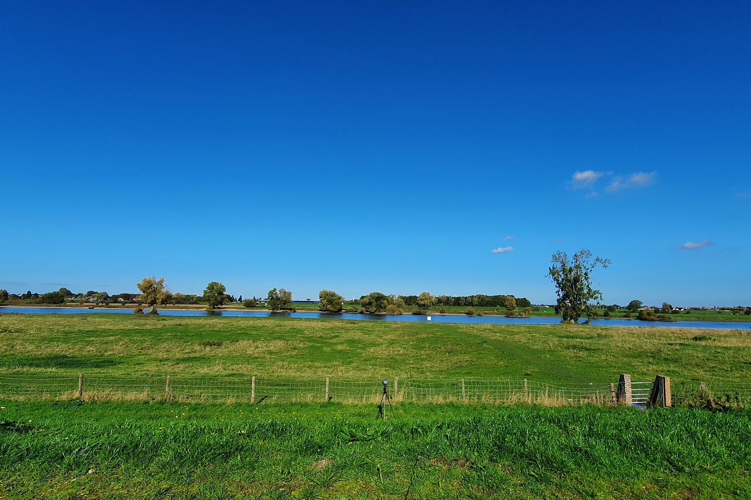
Rivers in the Netherlands don't run in a narrow bed. Between the river and the big dike there is a wide band of grassland, the uiterwaarden (floodplains), that is allowed to flood in winter. In summer it's grazing land with cows, old clay pits full of water, hawthorn and a lot of birds.
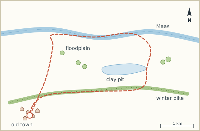
This loop takes you from the old town walls straight into that floodplain, out to the river itself and back along the top of the dike. On the way out you are down at water level and can't see much past the next hedge. On the way back you're up high and see everything you just walked through.
I walked it on a bright September Sunday. The light on the river was almost too much. Barges going by very slowly. Somebody's dog swimming after a stick.
Sketch map
Directions
- From the square walk through the old gate in the town wall and down to the river side of the town. (0.5 km)
- Go through the cattle gate onto the grass path into the floodplain. Keep the ditch on your left. (1.4 km)
- Follow the path towards the river until you reach the gravel track along the water. Turn right, downstream. (2.8 km)
- Walk along the river past two groynes, the stone dams sticking out into the water. You can sit on them. (4.6 km)
- At the old clay pit (a long pond with reeds) turn right and follow the path between the pond and the hedge. (5.9 km)
- Climb the ramp up onto the winter dike and turn right along the top. (6.8 km)
- Follow the dike back towards the town. The floodplain you walked through is below on your right. (9.6 km)
- Leave the dike at the first houses and walk back through the gate to the square. (10.5 km)
Notes
High water
When the river is high the grass path in step 2 and the riverside track can be under water and gates are closed. Then just walk out and back on the dike; it's about the same distance.
Cattle
There are often cows in the floodplain, sometimes with calves. Walk around them calmly, and dogs on a lead here.