Routes / Rivers & small towns
The Waal floodplain at the end of October
Published
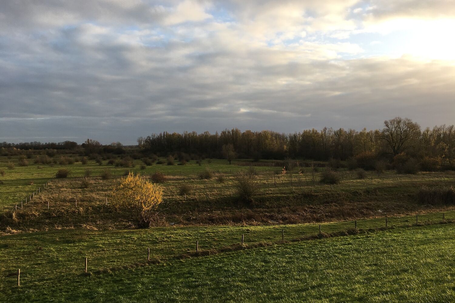
The Waal is the big one: the busiest river in the country, with barges going by all day, and wide floodplains where the old clay pits for brick-making have been turned back into nature. There are wild horses and Galloway cattle grazing, and nobody minds you walking among them as long as you keep your distance.
I walked this the last weekend of October. One of those days that can't decide: dark cloud, sudden sun, a rainbow, then rain. The light kept changing and the floodplain looked different every ten minutes. The little tree in the photo was the only bright yellow thing for kilometres.
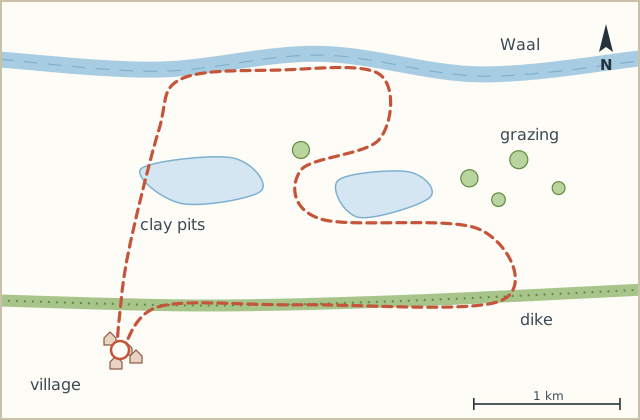
It's a simple loop. Out through the floodplain to the river, along the river for a bit, back on the dike.
Sketch map
Directions
- From the church walk up to the dike and cross it. Go down the ramp on the river side into the floodplain. (0.5 km)
- Follow the gravel path towards the river, past the first of the old clay pits. (1.8 km)
- At the river turn left along the beach. Barges pass very close here; their wash comes up the sand. (3.5 km)
- Leave the river at the post with the green band and follow the grass path inland, between two pools. (4.6 km)
- Through the gate into the grazing area. Horses and cattle, keep 25 metres away and don't stand between them. (5.7 km)
- Leave by the far gate and climb onto the dike. Turn left. (6.3 km)
- Follow the dike road back to the village. (9.0 km)
Notes
Mud
The grass path in step 4 is churned up by the cattle in autumn. Boots, again.
Barges
The wash from a passing barge comes surprisingly far up the beach. Don't leave your bag at the waterline. Not that I did.