Routes / Polder
Mastenbroek: ditches drawn with a ruler
Published
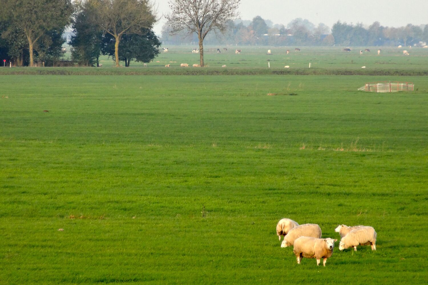
I started this notebook because of this polder, more or less. Mastenbroek was laid out in the fourteenth century and somebody back then clearly owned a very long ruler: the ditches run dead straight for kilometres, the farms sit on them like beads, and the whole thing is so regular it looks drawn rather than grown.
A polder, for anyone new here, is low land that has been closed in by dikes and is kept dry by pumping the water out. Mastenbroek is a textbook one. You walk on the old farm roads with water on both sides, then climb the dike at the end and suddenly see how low you were all along.
I did it on a grey March morning with mist hanging in the ditches. Sheep, lapwings, one heron that refused to move. Nothing spectacular, and I loved every minute.
Sketch map
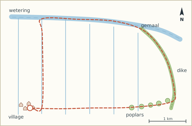
Directions
- From the church, walk east along the main village road and take the first narrow farm road on the left, next to a white farmhouse. (0.3 km)
- Follow this road straight north. It doesn't bend once. Ditches on both sides, farms every few hundred metres. (2.5 km)
- At the T-junction with the wide canal (the wetering, the main drainage canal of the polder) turn right and walk along the water. (3.6 km)
- Cross the small iron bridge and carry on along the far bank until you reach the brick gemaal, the pumping station that keeps the polder dry. (4.8 km)
- Climb the steps up the dike behind the gemaal. Go right along the top. Two stiles, so sheep can't escape. (5.0 km)
- Stay on the dike heading south-east. The river side is on your left, the polder lies below you on the right. (7.2 km)
- Where the dike meets a road lined with tall poplars, come down and follow that road west. (7.9 km)
- Take the second farm road on the left. It brings you back across the middle of the polder. (9.3 km)
- Keep straight on past three farms to the village road, then right back to the church. (11.5 km)
Notes
Wind
Everything here runs in straight lines, so a headwind stays a headwind for a long time. On days with a strong westerly I walk the loop the other way round and keep the dike for last.
Where to sit
There's a bench on the dike just past the gemaal, facing the polder. As far as I know it is the only bench on the whole loop, so plan your coffee break around it.