Routes / Dunes & coast
Schoorl: up and down the white dunes
Published
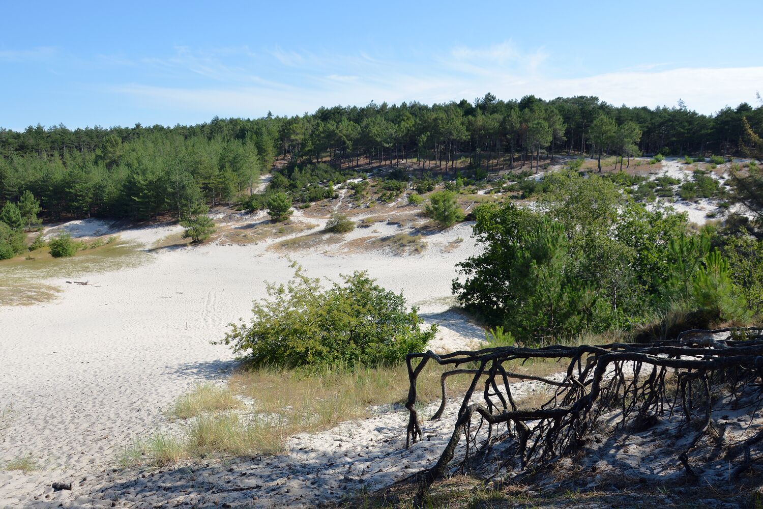
The dunes near Schoorl are the highest in the Netherlands, which in our country means that at the top you are about fifty metres up and you feel like a mountaineer. They are also wide: almost five kilometres of sand, pine and heather between the villages and the beach.
This loop goes through the middle of it. It starts in the shade of pine woods, climbs one steep sand ridge and then crosses an open stretch of white drift sand that is still moving. Then down towards the sea, which you hear before you see it, and back through birch and heather.
Ten kilometres sounds like nothing. In loose sand it is a lot more. I count my usual 4.5 km an hour down to about 3.5 here, and that was on a cool day.
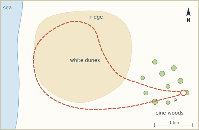
Sketch map
Directions
- From the car park take the wide sandy path straight west into the pine woods. (0.8 km)
- At the crossing where five paths meet, take the second path from the right. It narrows and starts to climb. (1.6 km)
- Climb the steep ridge. Short but hard going. At the top you see the dunes stretched out in front of you and the village roofs behind. (2.3 km)
- Follow the ridge north over open white sand. The big sand bowl from the photo is on your left after about a kilometre. (4.0 km)
- Keep going north-west and gently down, through low pines, until you reach the paved path to the beach. (5.4 km)
- Turn left (south) on the footpath that runs parallel to the bridle path. Keep the horses to your right. (7.2 km)
- At the junction with a wooden fence, turn left (east) through birches and patches of heather. (8.8 km)
- The path drops back into the pine woods and brings you out at the car park. (10.0 km)
Notes
Sand
After a dry week the sand on the ridge is soft and deep and you slide back half a step for every step up. After rain it's firm and much easier. One of the few times I'm happy with rain the day before.
Variant
From step 5 you can walk on to the beach and back. That adds about 2 km and a lot of wind in your face.