Routes / Polder
Waterland: two villages and a lot of sky
Published · updated
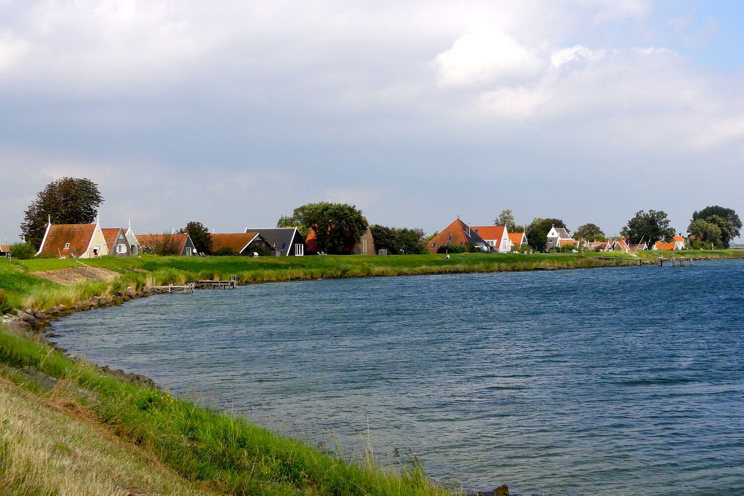
Waterland is the green bit just north of Amsterdam that everybody flies over and nobody seems to walk in. It's peat land: soft, wet meadows cut up by narrow ditches, with the ground slowly sinking. The villages are old, many houses are wooden and painted green or black, and the churches are small.
This loop goes from one dike village, inland through the meadows to a second village and back to the Markermeer along the dike. Most of the time you see only grass, water and sky, and a farm now and then. The ground under the paths gives a little when you walk. You feel the peat.
On the last stretch along the dike the first village appears across the water. That's the photo. It looked like a painting, honestly, I'm not exaggerating.
Added March 2025: the wooden footbridge in step 5 was closed for repairs for a few weeks. The detour through the village is about 300 m extra.
Sketch map
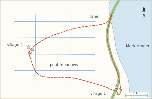
Directions
- From the bus turning point walk into the village and take the lane inland, away from the dike. (0.6 km)
- Where the lane bends, go through the kissing gate onto the path between the meadows. (1.5 km)
- Follow the meadow path west. It's narrow, with ditches on both sides, and quite soft after rain. (3.8 km)
- At the tarmac lane turn right and follow it to the second village, past a few farms. (5.6 km)
- In the village cross the canal by the narrow wooden footbridge and walk through to the far side. (6.4 km)
- Take the lane north-east out of the village. It runs straight along a wide ditch to the dike. (8.9 km)
- Up onto the dike and turn right. The Markermeer is now on your left. (9.4 km)
- Follow the dike back. At the inlet you see the first village across the water. (12.2 km)
- Down off the dike into the village and back to the bus. (13.0 km)
Notes
Wet feet
The meadow path in step 3 is peat and is wet for most of the year. Boots, not shoes. Or walk the loop the other way and skip it by staying on the lane (about the same distance).
Birds
In April and May the meadows are full of lapwings and godwits with young. Stay on the path and keep dogs close.